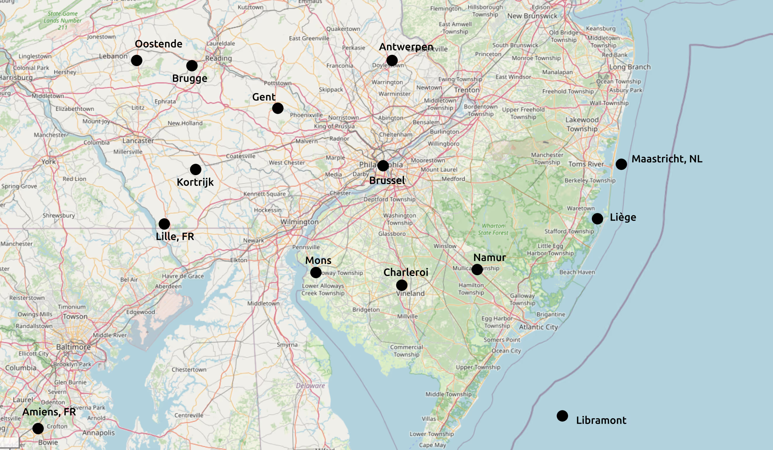
Comparing City Locations Between Belgium and the Greater Philadelphia Area
I grew up in Belgium so distances between the cities there just intuitively make sense. Some of my time has also been (and will also be) spent in the greater Philadelphia area, where I still do not have that intuition. As I have gotten more interested in both maps and silly running adventures, I find myself grasping for a better comparison of the distances and cities of my home country and my adopted area.
I was tinkering with some ideas today and ended up making the following very simple map view. In it, I overlay the location of Belgian cities on a map of Philadelphia and beyond. Nothing earth shattering, nothing particularly pretty, but after I made it, I felt in a mood to enshrine it here and share it. Falls in the category “I want to be able to quickly refer to this for other people”. Who is it useful for? Probably mostly Belgians that happen to have to be in this area.
The center points of the map are Philadelphia and Brussels. These two are linked, the other Belgian cities are placed in reference to them.
Future work: Perhaps a more zoomed out version properly showing New York City and Washington DC, currently both are just a bit beyond the north-east and south-west corners of the map, respectively. I was not thinking about that when initially making this map and cannot be bothered to fix it now. See how readable things remain. Also see if I can get Paris and Amsterdam in the picture, though that would require quite a bit more zooming out still.
Future future work: interactive application that does it for you, see MapMartini and the, now defunct, MAPfrappe it was based on. Those just show polygons, I would want textual overlay like I ended up with here.
